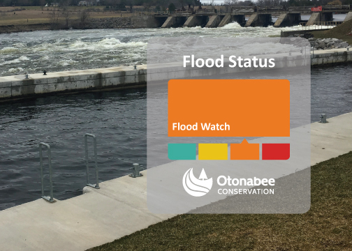
THIS FLOOD WATCH HAS EXPIRED - Flood Watch issued for Trent Severn Waterway - January 15, 2024

Message # 2024-02
Issued: 2:00 p.m., Monday January 15, 2024
Subject: FLOOD WATCH - issued for the Trent-Severn Waterway (i.e., Kawartha Lakes, Otonabee River, Rice Lake and Trent River to Hastings)
Issued to: Municipalities of Selwyn, Douro-Dummer, Asphodel-Norwood, Otonabee-South Monaghan, Cavan Monaghan, City of Kawartha Lakes, City of Peterborough and Trent Hills, and ORCA’s other partners in flood emergency management.
This FLOOD WATCH is issued to alert municipalities, residents, and businesses that floods are possible.
Due to the warm temperatures, rainfall, and snowmelt across the Trent-Severn Waterway during the holiday season and early January, Parks Canada is managing water through the entire system. As increased flows enter the Kawartha Lakes, water levels will increase and result in potential breakup of ice cover and ice jams. Flows on the Otonabee River have increased to convey the excess water within the system.
Cold air temperatures this week, combined with a lack of ice cover and turbulent flows on the Otonabee River may result in the generation of frazil ice which can lead to flooding.
Frazil ice – a kind of slush ice - can form when cold air temperatures and wind chill combine to cause surface water temperature to be super-cooled (i.e., cooled below the freezing point), but the super-cooled water is unable to form a solid cover of ice because of fast moving water. As frazil ice flows downstream, it will eventually come to rest against obstructions (e.g., islands, bridge piers and abutments), in low velocity areas (bends and slope reductions) or in areas of channel constrictions. Where it comes to rest, it will accumulate. Frazil ice may also anchor itself to the bottom of a watercourse and accumulate. Where frazil ice accumulates, it is likely to cause a restriction of water flow downstream, resulting in increased water levels and possibly flooding.
Residents and businesses along the shores of the Otonabee River and Kawartha Lakes, especially those located in low-lying areas, are strongly encouraged to keep a close watch for frazil ice generation, and fluctuating water levels, and to take action to limit or prevent damages due to potential flooding.
Water levels can be monitored on-line at:
- Trent-Severn Waterway’s Water Management InfoNet
- Water Survey of Canada Real-Time Hydrometric Data
- Otonabee Region Conservation Authority website/
This FLOOD WATCH message will expire Friday January 26th, 2024, unless up-dated earlier.
For more information:
Neil MacFarlane | Flood Forecasting & Warning Duty Officer | 705-745-5791 x 231
250 Milroy Drive, Peterborough, ON K9H 7M9
orcafloodduty@otonabeeconservation.com | Flood Watch Hotline 705-745-5791 x 228
Contact Us
250 Milroy Drive
Peterborough, ON K9H 7M9
Voice: 705-745-5791
Fax: 705-745-7488
Email: otonabeeca@otonabeeconservation.com
Subscribe to our News
Stay up to date on Otonabee Conservation's activities, events, programs and operations by subscribing to our News.
